
The USGS has a huge array of resources including: Data and Tools, Maps, Software, Publications and Multimedia. They have sections that cover Earthquakes, eater, remote Sensing, Volcanoes and Landslides
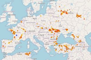
Live Lightning – Follow Those Storms!
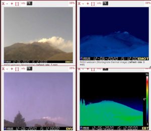
Volcano Cams
San Andreas Fault Sensors – USGS

The USGS offer lots of live webcams and monitors. This is example is is the 66 monitors around the San Andreas fault that can be monitored live.
British Geological Survey – UK Sensors
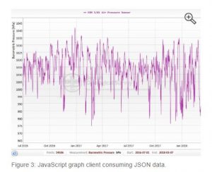
The British Geological Survey have links to a lot of live monitors, throughout the UK. A great way to engage in the dynamics of geoscience in the UK.